In Misadventures in Catfishing Part One, I wrote at
length about my experiences fishing with my cousins on the Kaskaskia River in
Central Illinois. I was lucky enough to visit them just about every summer from
my eleventh until my eighteenth year. Looking back on those times, if there was
anything I regret it’s that I didn’t have a camera
except for one of my last camping trips down there around 1990.
The recent passing of my cousin brought me back to the area this past weekend. After the ceremony, I took
some time out to go walking along the river where we used to fish. As one might
expect, a lot has changed in the past 30 years or so. Yet, in some other ways a
lot has remained the same. Bank poles still line the river in places, but now they’re
made of PVC pipe. I heard a small boat going up the river and around the bend...the song (of the outboard) remains the same!
Initially, I thought about how you “can’t go
home again”. And in some ways, that’s always true with the passage of time.
However, perpetual change is a constant with any river system. As I've said before every trip to
the river is time well spent.
Since I took a bunch of new pictures, I thought it would be
fun to compare them to my old pictures. One huge difference is the water level.
In my old pictures (taken with a 110 camera and eventually scanned), the water
was very low due to it being a dry summer. In the recent pictures, the water
level is up pretty good. Not bank full by any means, but a nice water level to
run the river by boat and fish for some cats.
View looking downstream from in front of the trailer...

Here’s the beach directly in front of the
trailer. The cut bank seems to have eroded. The river used to be shallow most of
the way across until you got right to the cut bank section where it was several
feet deep.
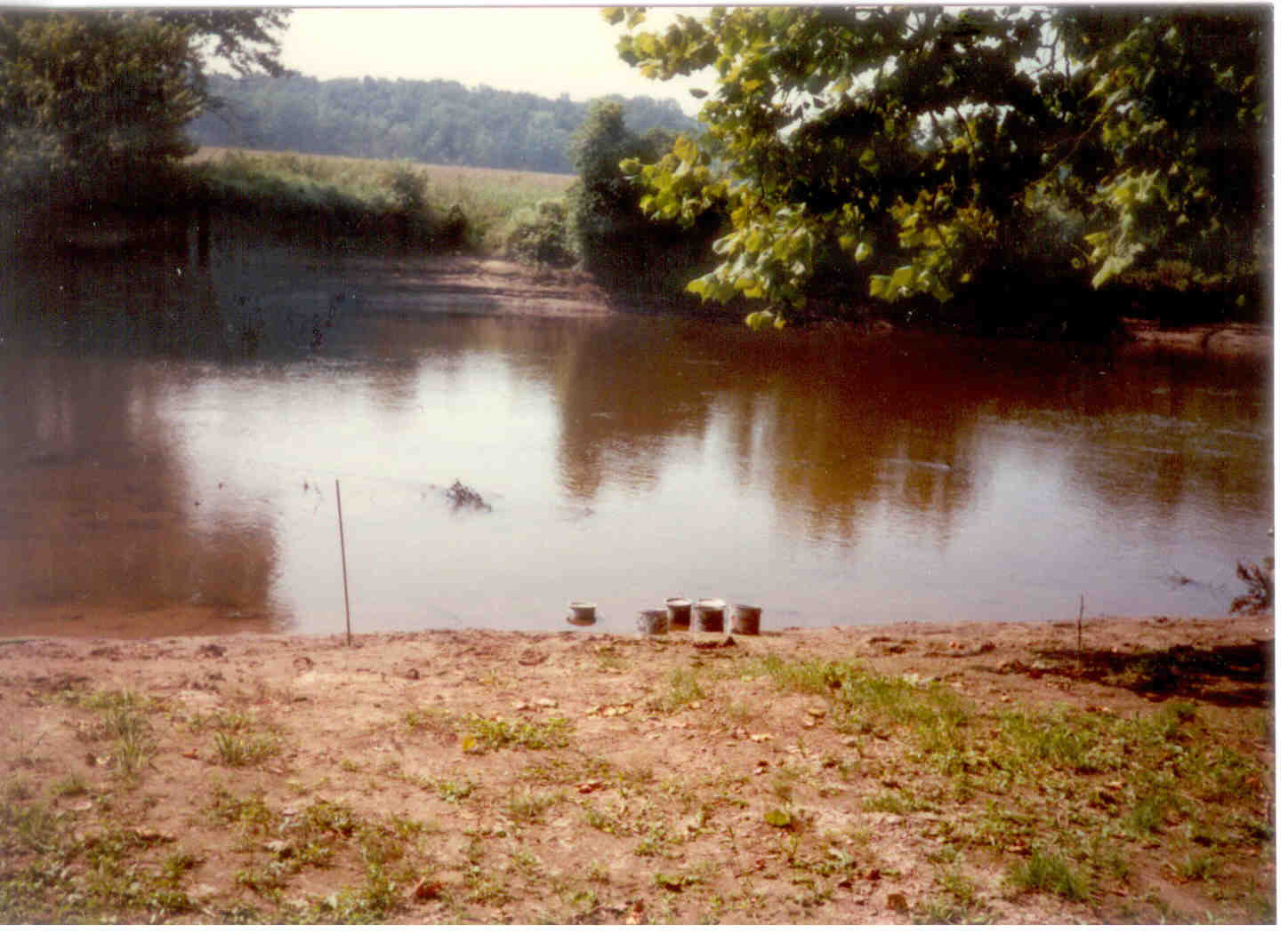
2017.
Looking up river towards the trailer. The trailer was just across from the point that sticks out on the left bank. The beach in front of the trailer would be on the right just past the old tree sticking out over the water.
Looking up river towards the trailer. The trailer was just across from the point that sticks out on the left bank. The beach in front of the trailer would be on the right just past the old tree sticking out over the water.

View of the trailer from the beach area.

Here’s a picture from the opposite bank looking towards where the trailer was. Most of the old beach would be under water,
so it’s a little hard to tell how much has actually changed. They used to keep it mowed, it's all overgrown these days...

Here a picture looking across the river from a spot near
where the trailer used to be. As you can see it’s so overgrown now, you can
hardly tell there was ever a fishing trailer there. And a lot of the old cut bank is gone...

View upstream towards Pee Wee’s Hole. Notice the big cutbank
by the snag. That water along the cut bank opposite of the big sandbar was
several feet deep, even in times of low water.

In this panorama from the opposite bank, you can see the
trees by the point by the snag. The cut bank has been eroded away due to the
river cutting across the narrow strip of land there during periods of high
water. While there’s still a good snag to fish, it’s changed quite a bit in the
past 25 years since I’ve fished there. Just left of center there was a giant
submerged log where the hoggers used to noodle for catfish and giant carp.
Wonder if that’s washed away, silted in, or still there. Maybe someday I’ll get
back there in a boat to find out!

Here’s an aerial view where you can see where the river was
cutting across during high water. My guess is the waterline is in low water
here is about the same place as where the old cut bank used to be. They’ve
added a lot of rip rap here to counteract the erosion that’s been occurring. If
the river keeps working on it, the big bend area that’s just upstream will
become an oxbow.

As a reference, here’s a larger shot of the area near
where the trailer was. The trailer was situated in the lower right hand corner
of the picture. The first big sandbar is the area we call Pee Wee’s Hole. There
was a huge cut bank at the beginning section of the big bend in the river,
opposite of the big sandbar area. I used to bank fish all along this area, we
also ran a lot of bank poles back then too.

Here’s what the big bend looks like now. It used to be a
steep cut bank, all dirt. They’ve added a lot of rip rap to counteract the
erosion that’s been happening.

One last wide shot from a little further up the bend…the big
sandbar is underwater, but the aerial photos show it’s still there. Except for
all the rip rap that’s been added, this section doesn’t look at lot different.
We used to get a few bank poles in along the old dirt banks.

No more willow or cane poles!

As much as the river as changed, it still seems the same. Grateful for all of the fond memories!
